

I make frequent long-distance trips in my 2017 Chevy Bolt EV, a car that is derided by many in the EV world as being incapable of making long trips quickly and conveniently, even when compared to other electric vehicles. That has not been my experience, so I wanted to share my methods for trip planning and execution using an actual, real-world trip. In this case, my regular 1,000-mile trip to Northern California and back.
This will be a three-part series. In this, Part 1, I will explain how I plan my trip. These are the same strategies and tactics I use for all my long trips, regardless of whether they are one of my regular trips or a new trip that I am making for the first time. In Part 2, I will summarize the first 500-mile leg of the trip, and in Part 3, I will review the planning and execution of the return trip and provide an overall trip summary.
A quick side note: This story will be published after I've already completed the first leg of the trip, but my planning and predictions below were all made beforehand. Now, on to planning my trip!
Initial Route Assessment
I want to start by stating that I don't use EV route planners (programs that provide guidance on where and how long to charge a specific EV in order to complete a trip). While I understand the allure of EV route planners, in my opinion, most do not accurately represent the car or the available charging infrastructure, which are the main reasons to use a route planner.
Drivers who are new to their EVs or have never taken them on long trips do need to know the efficiency of their cars at freeway speeds, the chargers that are available for them to use, how long they need to stop at those charger, and how far they can go before they need to stop and charge again. Because I'm already familiar with those things (and I initially traveled with the intent to learn them), I plan my trips myself. The only tools I use for assessing routes are PlugShare and Google Maps.
The first thing is, of course, to decide where I am going. Then I assess possible routes, determine which of those routes are feasible, and if any are, whether they fit my expectations for the trip. For me, feasibility is principally based on the availability and speed of chargers at regular intervals along the route, but it can also be based on road closures, conditions, and even traffic. My expectations are typically based on time constraints (such as a short weekend) or stopping at specific locations or venues along the way.
For my trip to Northern California, I have three reasonable routes to choose from: Highway 99, Highway 101, and Interstate 5 (I-5).
I'm not taking Highway 101 because I'm leaving from work, and Highway 101 would add 25 miles and over an hour to the total trip time. Plus, I have no reason to stop in the Bay Area along the way. I'm also not taking I-5 because it is a busier route, and while it has just enough chargers in key locations to support travel, those chargers are all the older, slower 50 kW units.
Highway 99 is my preferred route because it has more, faster charging locations with more amenities. My drive takes me past Sacramento, so Highway 99 only adds 4 miles to my trip compared to I-5, which I think is an acceptable tradeoff. My other reason for choosing Highway 99 for this leg of the trip is that several new charging sites have come online, and one is almost perfectly located for my trip along the route.
Check for Elevation Changes
One important factor to check when assessing the route is elevation changes, so use a tool like Google Maps to determine the topography of your route. This tool isn't currently built into Google Maps for cars (though it should be), but they do provide that information under the cyclist option. Be aware that the cyclist view in Google Maps doesn't always show the exact same route that you would be traveling by car; however, it should indicate whether any significant elevation changes occur along the route.

For my trip, I'm starting at almost 500' above sea level, and I need to cross over a mountain range with several summits that are over 4,000'. While that 3,500' in elevation increase does negatively impact efficiency and energy use, I will recover most of that extra energy after descending from the mountains. My first charging stop will be at about 300' in elevation, which is a net elevation change of only 100', so crossing those mountains will have a minimal impact on my trip.
However, my destination is well over 1,000' above sea level, so my 500-mile trip north will have an overall net elevation increase of close to 1,000'. That is not a huge difference, but it is a noticeable increase in energy usage. The Bolt EV will use an additional ~1.5 kWh for every 1,000 feet of net elevation increase, which equates to about 5 miles of range at freeway speeds.
Check the Weather
After establishing that the route is acceptable, I like to check the weather. Typically, I'll keep an eye on the weather for several days leading up to the trip, and I'll adjust or change the route if necessary.
I actually had to abandon one of my early trips to Northern California after spending two hours stuck in a mudslide on the Grapevine (I-5), but it turned out to be a blessing in disguise because it delayed me enough that I was able to turn around at Madera after learning that I-5 was covered with more than a foot of water north of Sacramento. Those types of situations are why I typically take Highway 101 during winter.

In this case, the weather isn't bad enough to prevent me from taking Highway 99/I-5, but because this is such a long drive, I do spot checks of the weather along various points on the route. I now know that for most of my drive, I will have a 10 to 15 mph headwind, so I can expect worse than normal efficiency. That means that I will also need to expect slightly longer charging times.
Check for Updates
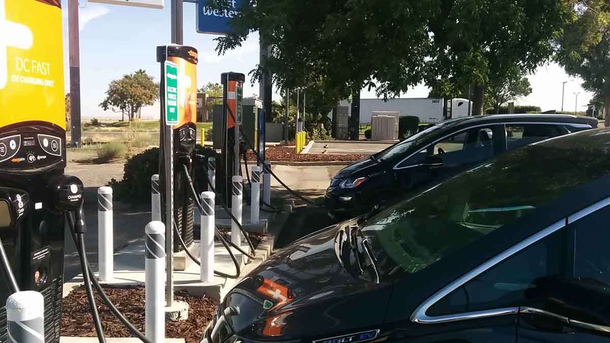
Even though I'm familiar with this route (I could drive it in the Bolt EV without any guidance or navigation), I check the status of various chargers I might use along the way. Sometimes, as in the case of this trip, there's an upgrade. A new Electrify America charging site recently came online in Turlock. On most of my trips up Highway 99, I find myself waffling between stopping at the EVgo in Atwater and one of the EVgo chargers in Modesto. Turlock is almost halfway between those two locations, so I could see this being one of my new, regular stops.
However, it's not all sunshine and rainbows. This trip is also presenting a red flag. One of my primary charging stops is the EVgo in Selma, and an EV owner reported that all chargers at the site were down. EVgo responded and acknowledged the comment; however, the status of the chargers has remained active the entire time. This occurred over a week ago, but I have seen no updates or check ins since.

The last time this happened, there had been a power outage in Selma, and the EVgo chargers were out of commission. Because I saw that before leaving on my trip, I made an extra, short stop in Delano about 65 miles south of Selma, and that allowed me to skip the chargers in Selma if they happened to be down. If I don't see any confirmations that the EVgo in Selma is up, I might do the same thing for this trip.
Create an Itinerary
Even for these trips that I do often, I like to set up an itinerary. This is just a basic framework, and I adjust it as needed. The main thing that I am looking to do with the sites I select is to maximize the distance I can travel between stops while maintaining the most effective charging rates.
For the Chevy Bolt EV, the ideal first stop after starting on a full battery is about 180 to 200 miles out, the ideal charging window is up to 70%, and the subsequent charge range (or ideal distance between charging stops) is 120 to 140 miles. I build my itinerary around those constraints.
This makes a first stop at Delano (135 miles out) awkward, but I don't have a high level of confidence in any of the other charging sites between Delano and Selma. Several EV Connect sites have been brought online, but they look to be the slower, 100 amp DC fast chargers. I also cannot confirm that the DC fast chargers are up because no one has checked in and specifically noted that they were using the DC chargers (they could have been using much slower AC chargers).
The EVgo chargers at Selma are almost 200 miles out, which is the upper limit of what I like to travel on 70 mph freeways (especially with a headwind), so I either risk getting stuck in Selma (if the EVgo chargers are down) or I making an unnecessarily early stop in Delano that adds a minimum of 20 to 30 minutes to my trip.
I typically handle this is by checking my battery level and efficiency as I approach Delano. If my Bolt EV still has at least 35% battery, I know that I should be able to make it to Selma without stopping. However, in this case, the main issue is that I don't know whether the EVgo in Selma is even available. This is the reason I encourage every EV owner I know to check in using PlugShare; it’s still the best tool the EV community has for communicating actual, real-time charger statuses.
Regardless of where I end up stopping between Delano and Fresno, I will make my next stop at the new Electrify America charger site in Turlock. This is the new charger that I was hoping to check out, and it is only 100 miles north of Selma. A 45-minute dinner and charging stop in Selma would give me more than enough range to drive to Turlock at full freeway speeds.
The Turlock site also sets up my next stop, which I plan to be the Electrify America site at the Sacramento International Airport about 100 miles north of Turlock. I recently reviewed the Electrify America site at the airport, and since my review, several EV owners have had the opportunity to use it. I have a high level of confidence in this site, but even if I didn't, the site also has a 50 kW GreenLots charger. Plus, the Turlock site still provides me with enough range in about 35 minutes to reach the Dunnigan Electrify America site, which is about 20 miles up the road from the Sacramento Airport.
Either of those stops leaves me with less than 100 miles to drive to get to my destination, so they would be the last DC fast charge of my trip.
Expectations
I avoid setting strict expectations for any trips I take simply because so many elements are outside of my control and having strong expectations can lead to disappointment. However, given my experience with the Bolt EV and the charging infrastructure, this is what I expect for the trip (assuming no significant traffic incidents).
The first 200-mile leg to from my starting point in eastern Ventura County to the Selma EVgo chargers will take about 3 hours and 15 minutes, an average driving speed of about 60 mph. I will spend about 45 minutes onsite eating dinner while I charge the car. By the time I leave, my average trip speed will have dropped to 50 mph.
The next 100-mile leg to the Turlock Electrify America chargers should take 1 hour 30 minutes, bringing my average trip speed back up to about 54 mph. I only expect to spend about 30 minutes charging, but I'm going to add 15 minutes of additional time because it's a new charging location that I've never been to before. By the time I leave, my average trip speed will be down to about 48 mph.
From Turlock, I will drive another 100 miles to get to the Sacramento International Airport Electrify America chargers, which should take another 1 hour 30 minutes. This will bring my average trip speed up to almost 52 mph. I will spend about 30 minutes charging, bringing my average trip speed by the time I leave back down to 48 mph.

The last 90 miles to my property in Northern California will take another 1 hour 30 minutes, resulting in an overall average trip speed of just over 50 mph. So the total trip distance will be just short of 490 miles and my anticipated trip time is about 9 hours 45 minutes. Again, though, that's if everything goes well, and I don't encounter any significant accidents or other slowdowns (a hard thing to do on a 500-mile trip).
See you next time for Part 2 when I review how the first 500 miles of my trip went and how well it fit my expectations!
About The Author
Eric Way focuses on reporting expert opinion on GM brand electric vehicles at Torque News. Eric is also an instructional designer and technical writer with more than 15 years of writing experience. He also hosts the News Coulomb video blog, which focuses on electric vehicles, charging infrastructure, and renewable energy. Eric is an active member of the EV Advocates of Ventura County, a volunteer organization focused on increasing the widespread adoption of electric vehicles. You can follow Eric on News Coulomb Youtube, on Facebook at @NewsCoulomb as well as on Twitter at @eway1978.
Set Torque News as Preferred Source on Google
Follow us today...


